


Aurea Location & Nearby Amenities
Explore transport, schools, shopping, healthcare and other amenities around Aurea.

Between the Historic City and the Waterfront
Aurea location, accessibility and convenience.
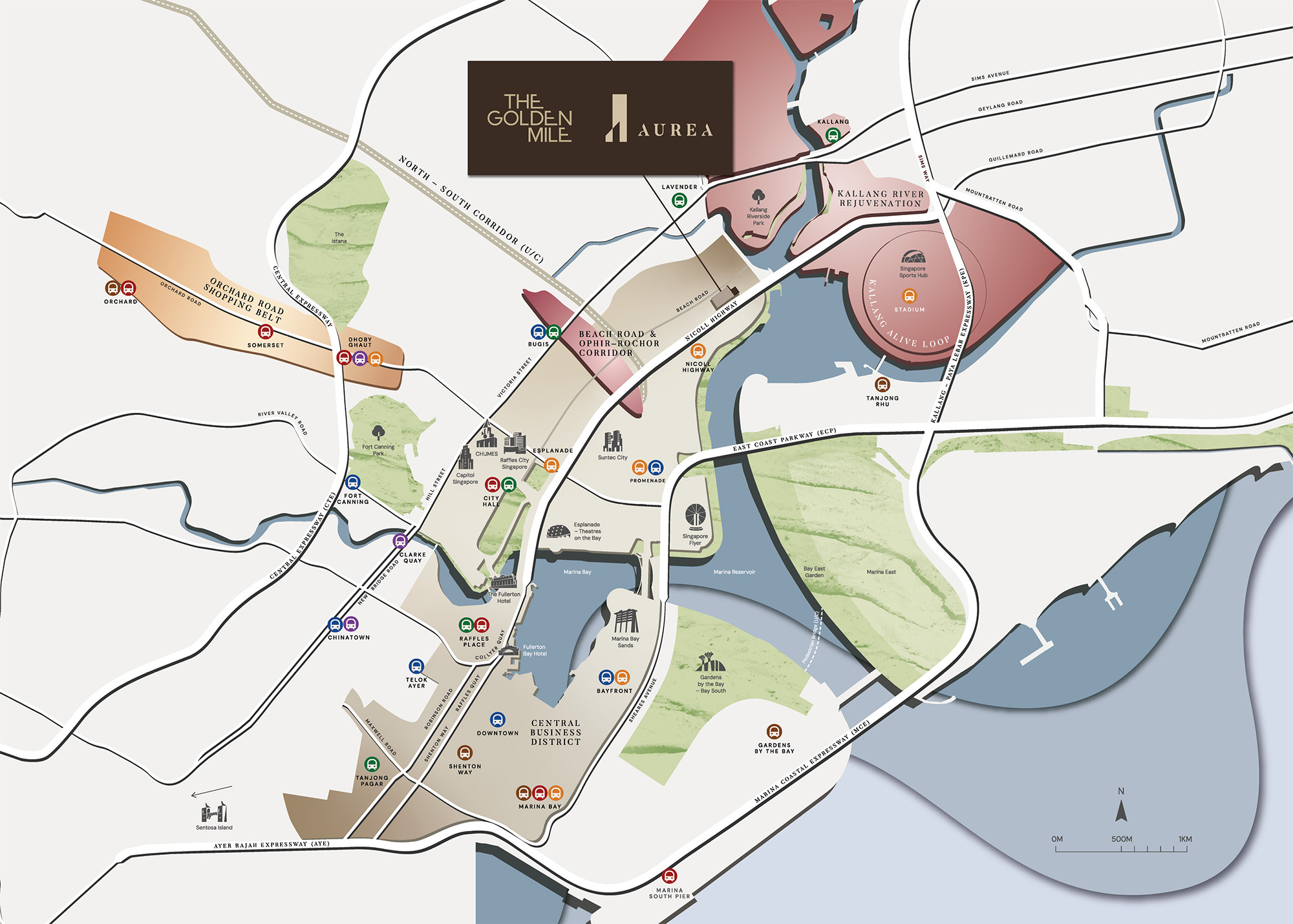
Aurea Location Map
See the project in relation to key transport, amenities and destinations nearby.
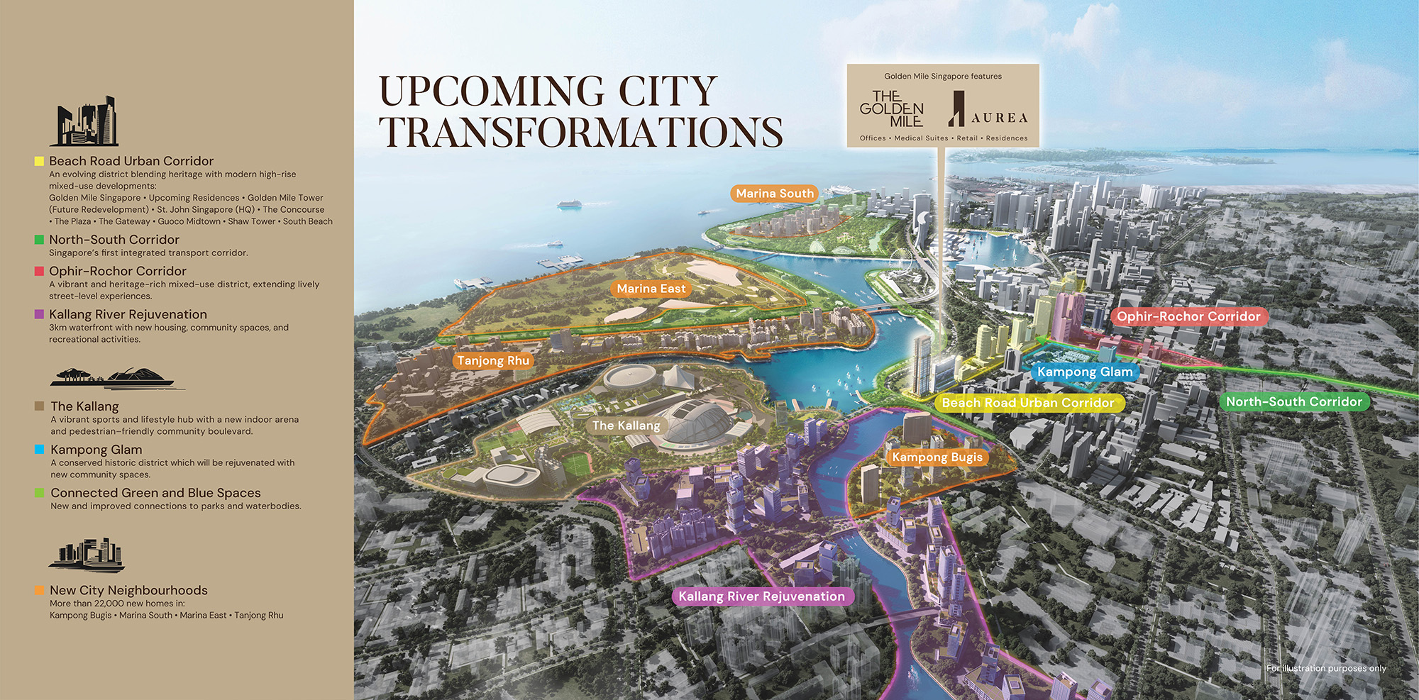
Beach Road occupies a particularly interesting position in Singapore's urban geography. From Aurea, the cultural streets of Kampong Glam and the Bugis district sit alongside the commercial activity of the Downtown Core, while the Kallang waterfront introduces a contrasting landscape of open space and recreation. Nicoll Highway MRT station on the Circle Line provides a nearby rail connection, with Lavender and Bugis stations extending access to other parts of the island.
The neighbourhood's appeal is also found in its everyday contrasts. Golden Mile Food Centre and the surrounding traditional streets bring an established local character, while Suntec City, the Bugis shopping district and the Marina Bay area represent another side of central Singapore. The restored Golden Mile adds a further dimension through its planned mix of retail, dining, offices and medical suites. It is this layering of heritage, contemporary city life and waterfront geography that gives Aurea its particular sense of place.
Explore Nearby Amenities
Distances shown are approximate straight-line distances from the project coordinates.
Interested in Aurea?
Check current availability, layouts and viewing arrangements with Homy嘉园.