


Sophia Meadow Location & Nearby Amenities
Explore transport, schools, shopping, healthcare and other amenities around Sophia Meadow.

Between Green Slopes and City Streets
Sophia Meadow location, accessibility and convenience.
Sophia Meadow Location Map
See the project in relation to key transport, amenities and destinations nearby.
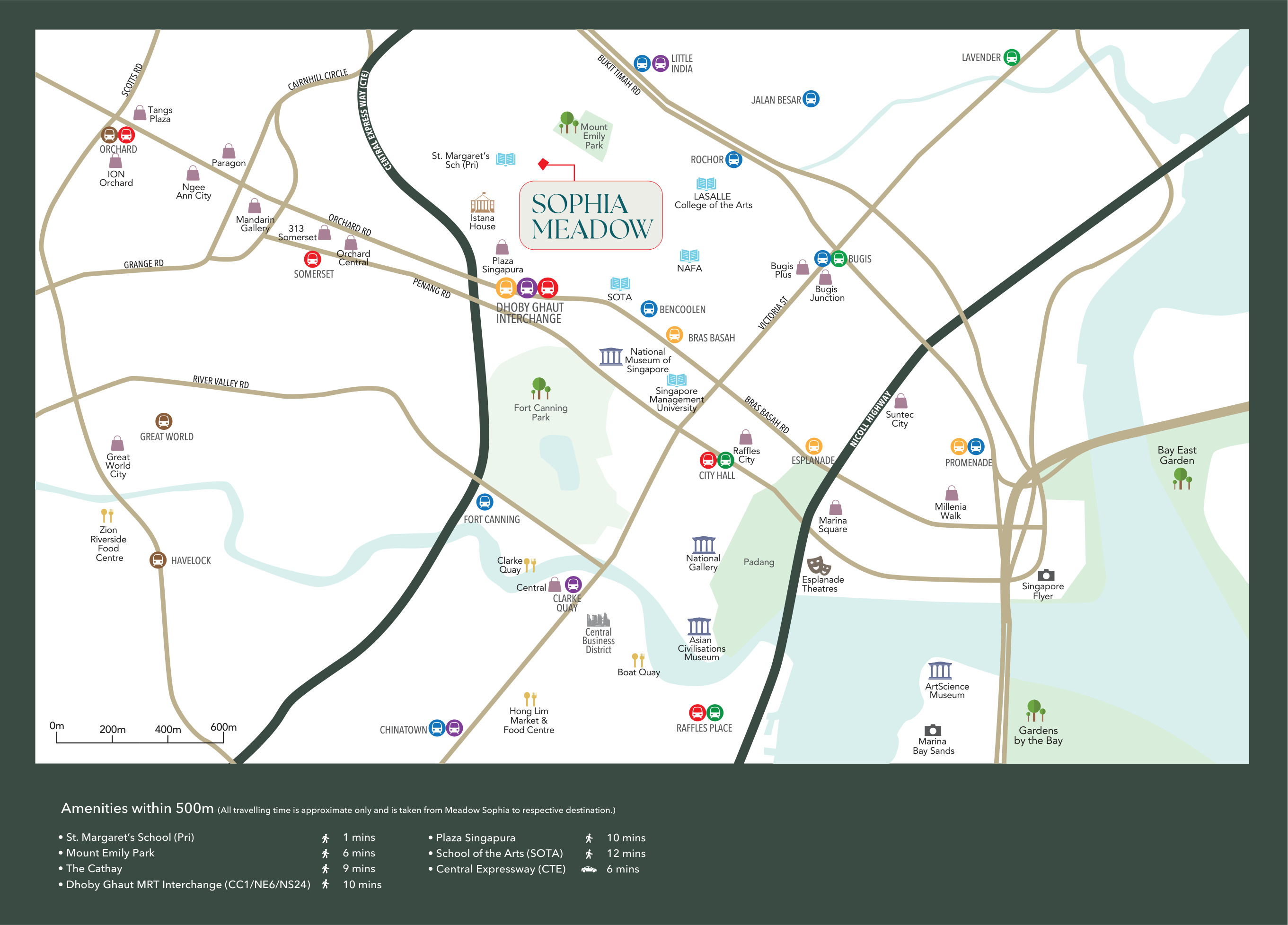
Sophia Road places the development in the Mount Sophia neighbourhood, close to Mount Emily Park and St. Margaret’s School (Primary). The green setting is part of the local geography, while Plaza Singapura, The Cathay and the School of the Arts bring shopping, entertainment and culture into the surrounding district.
Dhoby Ghaut interchange connects the North–South, North East and Circle lines; Little India station serves the North East and Downtown lines. Together, these nearby connections make the location useful for moving across central Singapore without treating every journey as a drive.
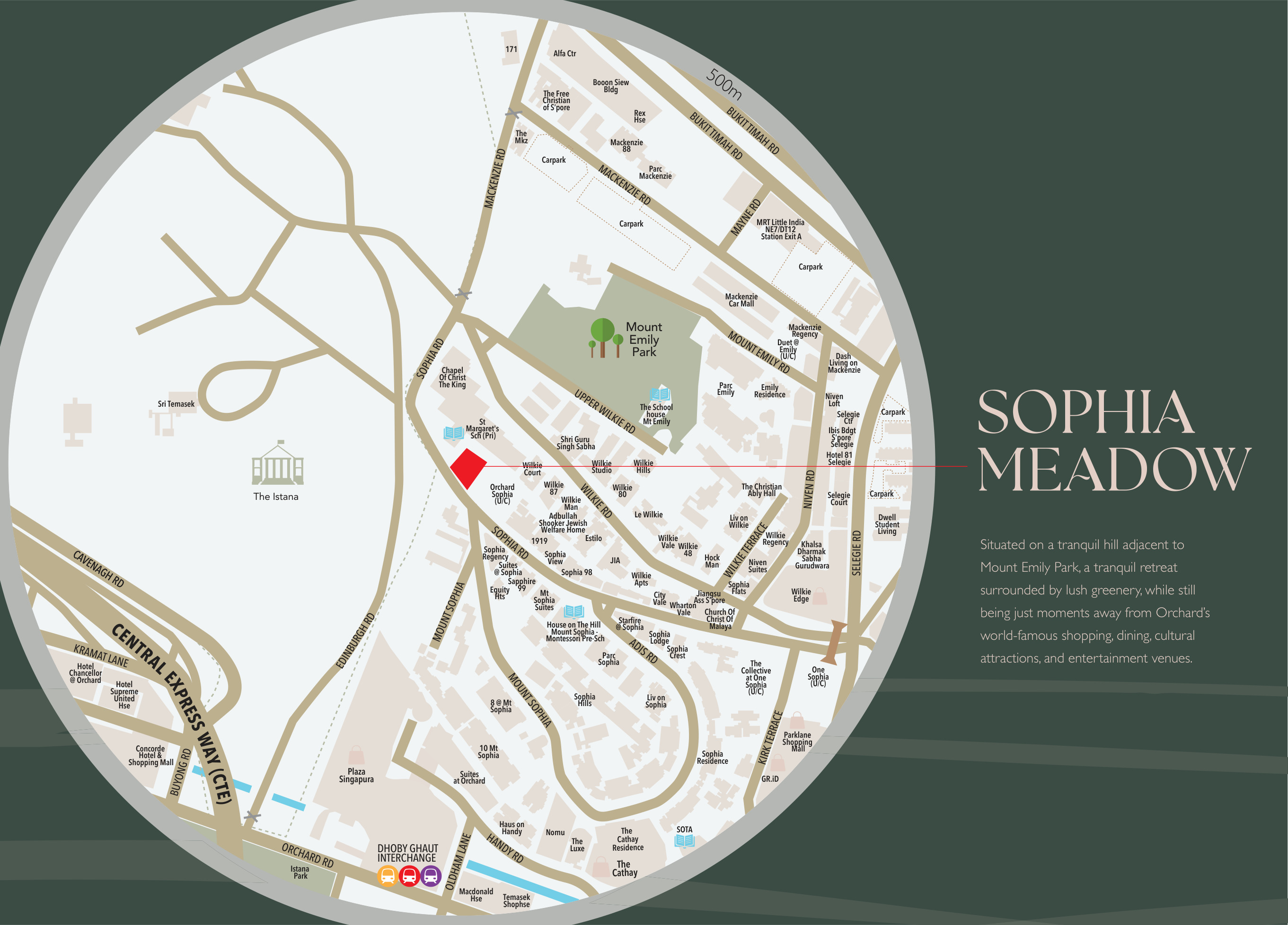
Explore Nearby Amenities
Distances shown are approximate straight-line distances from the project coordinates.
Interested in Sophia Meadow?
Check current availability, layouts and viewing arrangements with Homy嘉园.