


The Robertson Opus Location & Nearby Amenities
Explore transport, schools, shopping, healthcare and other amenities around The Robertson Opus.

Between the River and Fort Canning
The Robertson Opus location, accessibility and convenience.
The Robertson Opus Location Map
See the project in relation to key transport, amenities and destinations nearby.
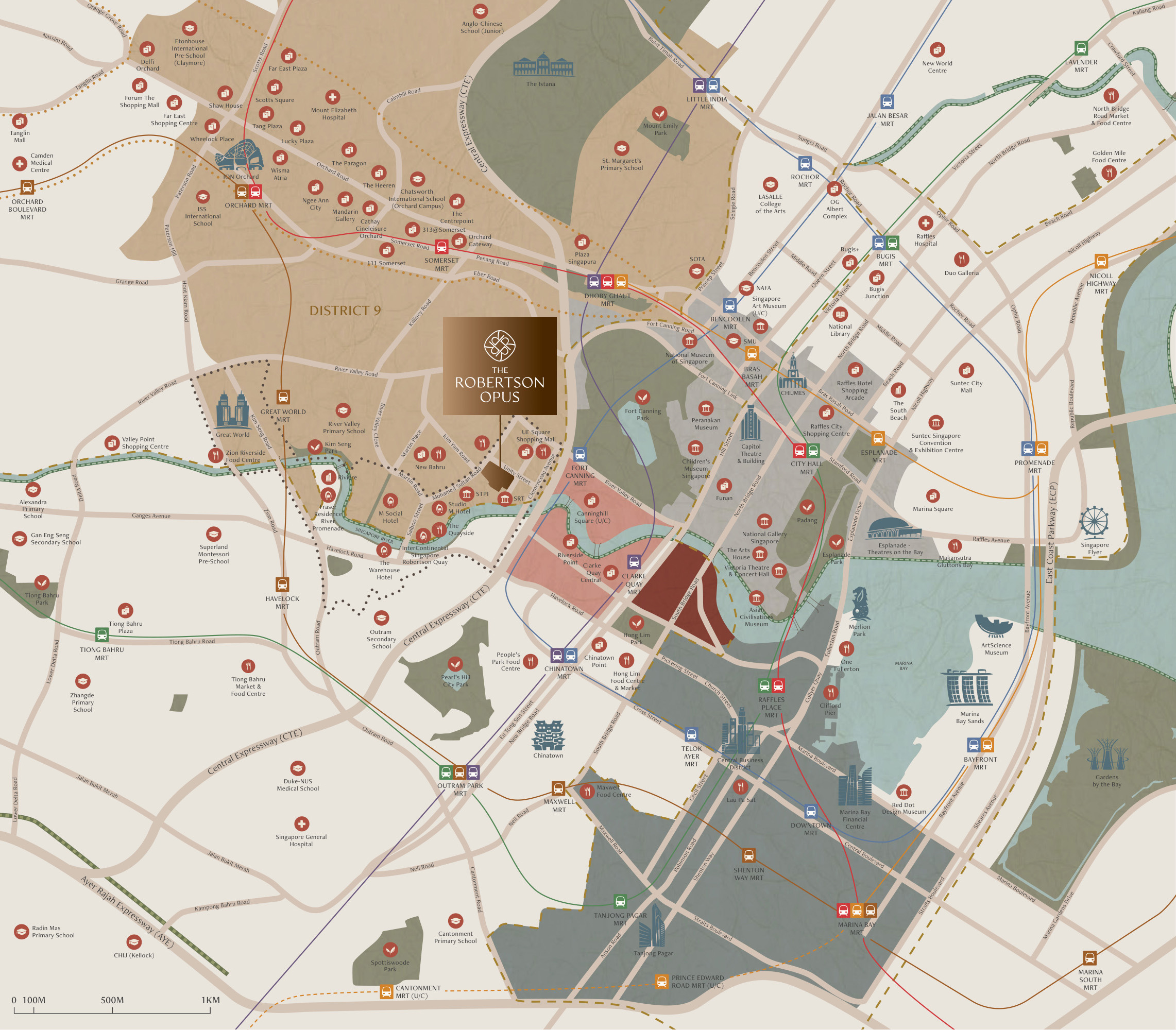
Robertson Quay has a character shaped by the Singapore River, its dining terraces, riverside promenades and proximity to the cultural districts around Fort Canning. The Robertson Opus occupies a position within this neighbourhood where a restaurant evening, a walk along the river or an afternoon in the park can each become part of ordinary city life.
Fort Canning MRT on the Downtown Line is nearby, while Clarke Quay MRT provides access to the North East Line. Orchard Road, the civic district and the Central Business District form part of the wider urban setting. The location brings together established residential streets, riverside activity and connections to several distinct parts of central Singapore.
Explore Nearby Amenities
Distances shown are approximate straight-line distances from the project coordinates.
Interested in The Robertson Opus?
Check current availability, layouts and viewing arrangements with Homy嘉园.