


Union Square Residences Location & Nearby Amenities
Explore transport, schools, shopping, healthcare and other amenities around Union Square Residences.

Between the River, Chinatown and the Civic Heart
Union Square Residences location, accessibility and convenience.
Union Square Residences Location Map
See the project in relation to key transport, amenities and destinations nearby.
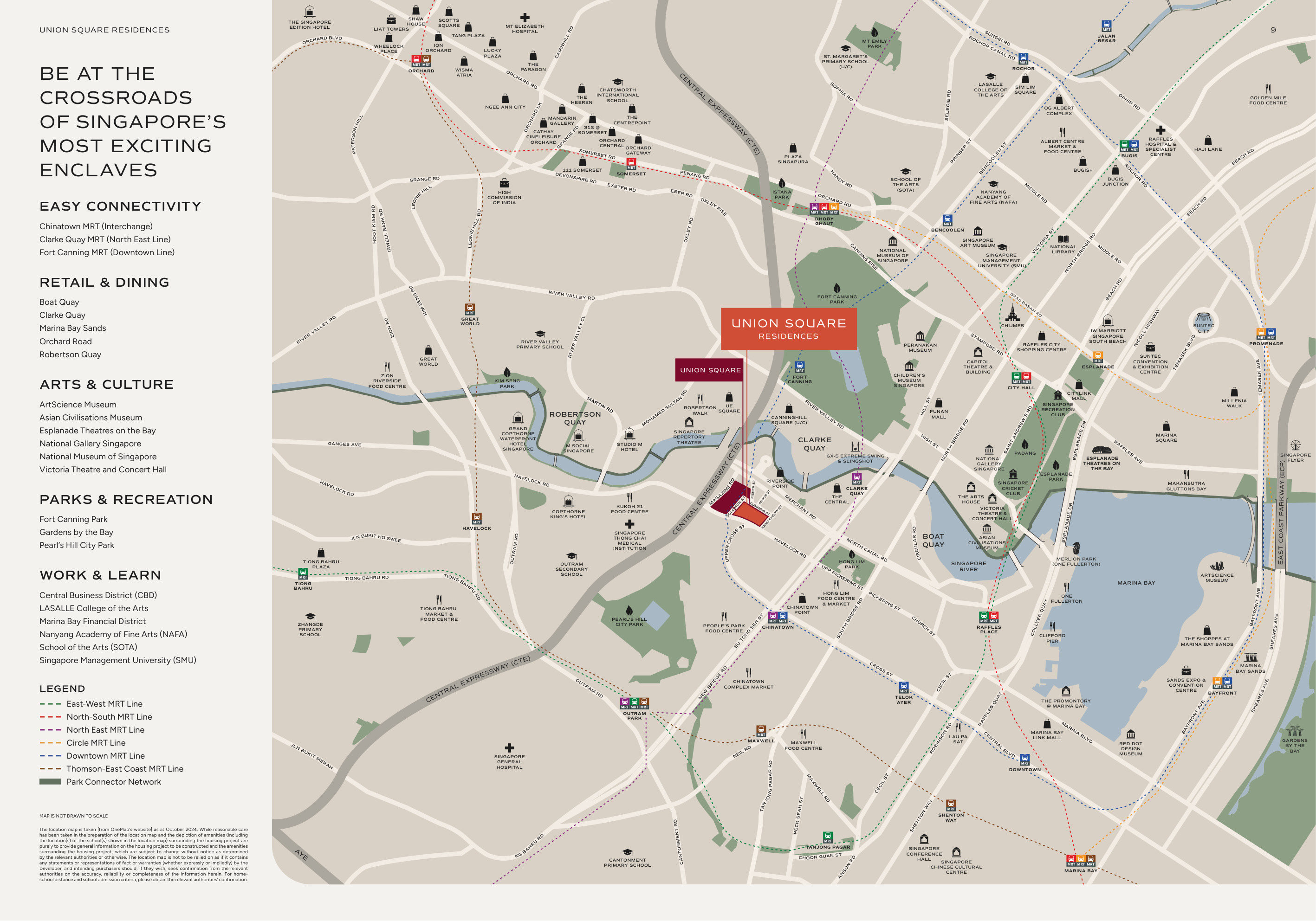
Havelock Road places Union Square Residences at the intersection of several distinct Singapore neighbourhoods. Clarke Quay and the Singapore River provide a setting of waterfront dining, entertainment and historic streetscapes, while Chinatown contributes traditional eateries, conserved architecture and an established cultural identity. In another direction, Fort Canning Park offers greenery, heritage landmarks and recreational paths.
Clarke Quay, Chinatown and Fort Canning MRT stations provide access to the North East and Downtown lines, with Chinatown also serving as an interchange. The surrounding urban network connects the development with Raffles Place, the Civic District, Marina Bay and Orchard Road. Museums, galleries, restaurants and public spaces give the location a depth of experience that extends beyond its commercial convenience.
Explore Nearby Amenities
Distances shown are approximate straight-line distances from the project coordinates.
Interested in Union Square Residences?
Check current availability, layouts and viewing arrangements with Homy嘉园.